TEK NET
The Henderson Amateur Radio Club is pleased to present our Tek Net every Sunday evening, starting at 8pm local time (0300 UTC).
The audio portion of the Tek Net will be found on the Henderson Amateur Radio Club Repeater Network (RF). The audio may also be accessed via Echolink (W7HEN-R node 740644) and Allstar (node 44045).
The audio will refer to this page, so that the listener can more fully understand the concepts as they are presented.
All are welcome!
November 20, 2022
“ASK the PROS” night with an added discussion on the Angel Peak site coverage projections.
ASK the PROS night, or as it is affectionally called by many “STUMP the CHUMPS” night.
Here is your opportunity to query the group on any problem or issue you may be experiencing with your radios…antennas…power supplies or electronics in general.
Many of our club members and Tek Net participants have years of experience to guide you and help resolve issues that can be a problem at times.
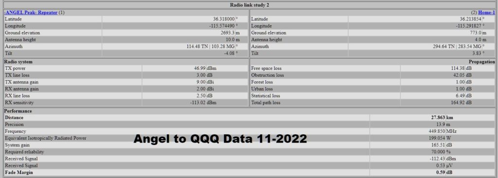
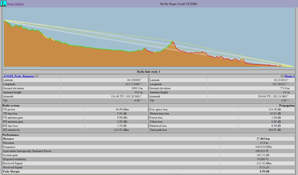
Also a short discussion about Angel Peak repeater site coverage maps that Dave W3QQQ did from his QTH.
This is not official data from the HARC BOD or TAG folks.
Please keep in mind that the data entered here is from Dave W3QQQ and not from the HARC BoD or Technical Advisory Group, this data may not be actual.
These coverage map images are from the Radio Mobile online software, available here…https://www.ve2dbe.com/rmonline_s.asp
Setting up an account is easy and allows you to do path plots from anywhere to your location selected in the program.
This program is great for comparing the coverage differences between antenna types or locations, and power differences in transmitters, etc.
Help is as close as your computer by going to this tutorial on Radio Mobile Online. https://www.youtube.com/watch?v=WJPPUk37jUA
ANGEL PEAK
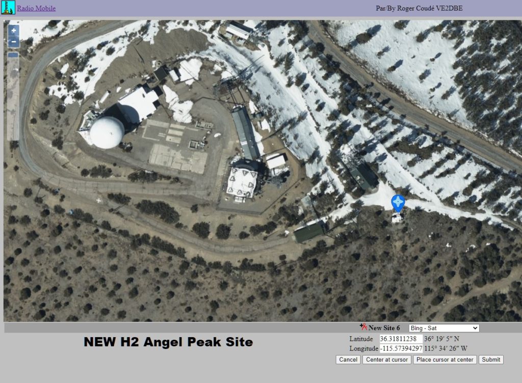
The blue bubble is the building we will operate the clubs H2 repeater from.
It is about 100 feet from the grey building that can be seen to the left of the blue bubble, which is the site for the FBI and other federal agency’s equipment.
Elevation is several thousand feet higher than the Apex site.
The Air Force’s radar dome ( Golf ball ) can be seen to the left in the photo.


The data that the program displays as well as the maps it creates are very accurate. Topographical data is from the United States Geological Survey service. For more terrain info and data go to https://www.usgs.gov/

